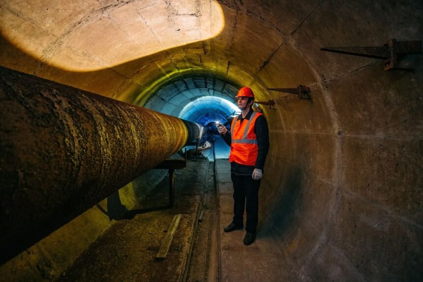
Cities inherit utility drawings from different decades, contractors and coordinate systems. Some records are approximate; others omit abandoned or newly added lines. Professional field surveys close the gap between what a drawing suggests and what is actually underground.
Why old utility records are not enough
The underlying issue is incomplete utility records, congested corridors, accidental strikes, project delays, and leaks that remain hidden below the surface. It should be defined in measurable terms before a team selects equipment or requests bids. A clear problem statement also prevents a survey from expanding into unrelated work. The scope should distinguish symptoms from causes and identify the consequence of doing nothing. That gives decision-makers a basis for ranking the work against other maintenance needs.
What a professional leak audit covers
In practice, this stage requires teams to collect existing records, plan the survey, scan with complementary methods, mark and survey findings, reconcile conflicts, and deliver usable maps. Asset identifiers, locations, dates and test conditions should remain attached to every finding. That creates an audit trail and reduces duplicate surveys. The workflow should define how urgent conditions are escalated and how routine observations enter planned maintenance. Separate paths prevent every result from being treated as an emergency.
Tools for metallic and non-metallic assets
Practitioners may use ground-penetrating radar, electromagnetic locating, acoustic methods, survey control, geospatial systems, AI-assisted interpretation, and field verification. No instrument should be treated as a black box. The operator needs to understand the measurement principle, common interference and the threshold for confirmation. Equipment capability matters, but operator competence often determines data quality. Training and documented procedures make results more consistent across crews, sites and reporting periods.
How experts report uncertainty
Guidance on underground infrastructure experts is most useful when it states both the available methods and the limits that affect the result. The main constraints are soil conditions, depth, material type, congestion, access, detection limits, and the need to communicate uncertainty. They belong in the technical scope because they can change accuracy, safety and usability. Critical findings may require confirmation by another method or physical exposure. The report should state confidence and explain what could not be determined. Honest limits help engineers choose safe follow-up work and prevent a preliminary finding from being used for a decision it cannot support.
How mapping prevents excavation strikes
Done well, the program supports safer excavation, better design decisions, fewer change orders, and a defensible understanding of subsurface conditions. The business case is strongest when a baseline exists and the same indicators are checked after implementation. That allows managers to separate real improvement from normal variation. Performance review should compare like-for-like periods and account for operating changes. Otherwise, normal variation may be mistaken for improvement or a successful intervention may be overlooked.
Using results in design and maintenance
The working sequence is straightforward: collect existing records, plan the survey, scan with complementary methods, mark and survey findings, reconcile conflicts, and deliver usable maps. Each stage should have an owner and an acceptance check. This makes delays visible and shows whether the result changed maintenance, billing, safety or environmental performance. Completion records should show what changed after intervention. A second measurement, inspection or operational check is often the clearest proof that the original issue was addressed.
Keeping the map current
The longer-term opportunity is living underground maps updated as assets are exposed, repaired, or newly installed. Repeated measurements and consistent records make trends visible. That evidence can move maintenance from emergency response toward planned intervention. A consistent asset history allows teams to compare the condition before and after work, identify recurring locations and plan renewal before emergency failure. It also makes future surveys faster to design.
What should teams confirm before an underground leak audit?
They should confirm the asset type, operating condition, required accuracy and the decision the result must support. For this topic, the main constraints are soil conditions, depth, material type, congestion, access, detection limits, and the need to communicate uncertainty. A short pre-field review should document those limits, identify any need for a second method and set the acceptance check for the final result.
How can owners verify the value of an underground leak audit?
Verification starts with a baseline and a measure tied to the intended outcome. Expected gains include safer excavation, better design decisions, fewer change orders, and a defensible understanding of subsurface conditions. Owners should compare conditions before and after the intervention, confirm that priority findings were closed and record any recurrence. That produces a direct answer instead of relying on a vendor claim or an untested estimate.
Conclusion
A useful underground map records evidence and uncertainty, not just colored lines. For cities, utilities, transport agencies, developers, and engineering consultants, the next step is to define the decision, choose evidence that can support it and assign responsibility for follow-up. That approach keeps the work factual, measurable and useful after the initial survey or installation.